Grd-i Tle - az erődítmény és település
Grd-i Tle lelőhelyen már az első ásatási szezonban kőrakásos erőd és település nyomait sikerült megtalálnunk. A több építési fázist megélt épületegyüttes a vaskor óta áll. Itt, az 1. felszínen nyitott kutatóárok a megtelepedések időrendi kérdéseire is választ ad majd.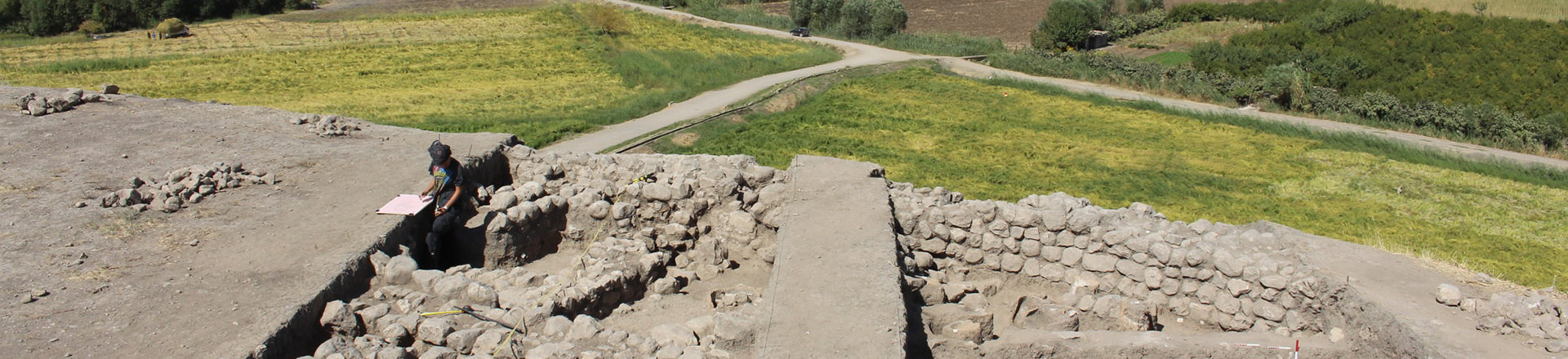
Bemutatás
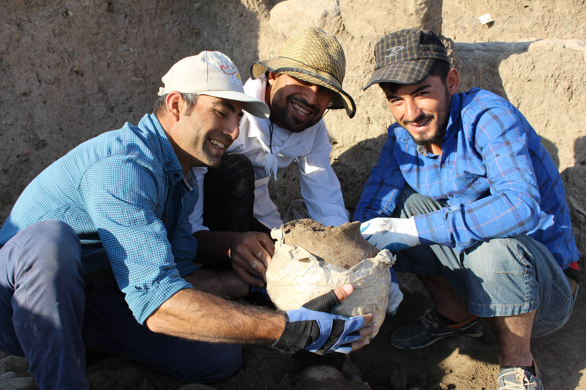
During the first excavation season of the Hungarian Archaeological Expedition of the Eötvös Loránd University, Budapest, three fields were open on the tell of Grd-I Tle. The largest of the fields was Field 01, where, in its NW Trench on the northern slope of the site remains of at least eight consecutive walls were discovered (extant stretches and debris of different walls). These walls are dated from the Iron Age to the 18th—19th century. Several metal objects retrieved from the trench help us to date the walls. The aim of the trench is to reach the bottom of the tell and establish a chronology of the site and the nearby region. Also at the Field 1, three levels of a settlement existed in the 18th and 19th centuries that undoubtedly can be connected with the local Kurdish population of that time. However, the function of the site is not yet clear.
The Fortifications of Grd-i Tle (Field 1)
During the season of 2016, in the NW corner of Field 01 a square trench was opened from the edge of the tell down on the slope in a northward direction. According to our plans this trench is going to reach the bottom of the tell within four further excavation seasons. The aim of the project is to try to establish the stratigraphy of the site and to build a pottery typology of the region. The technique is the step trench, in which a step would be cut at every archaeological phenomenon.
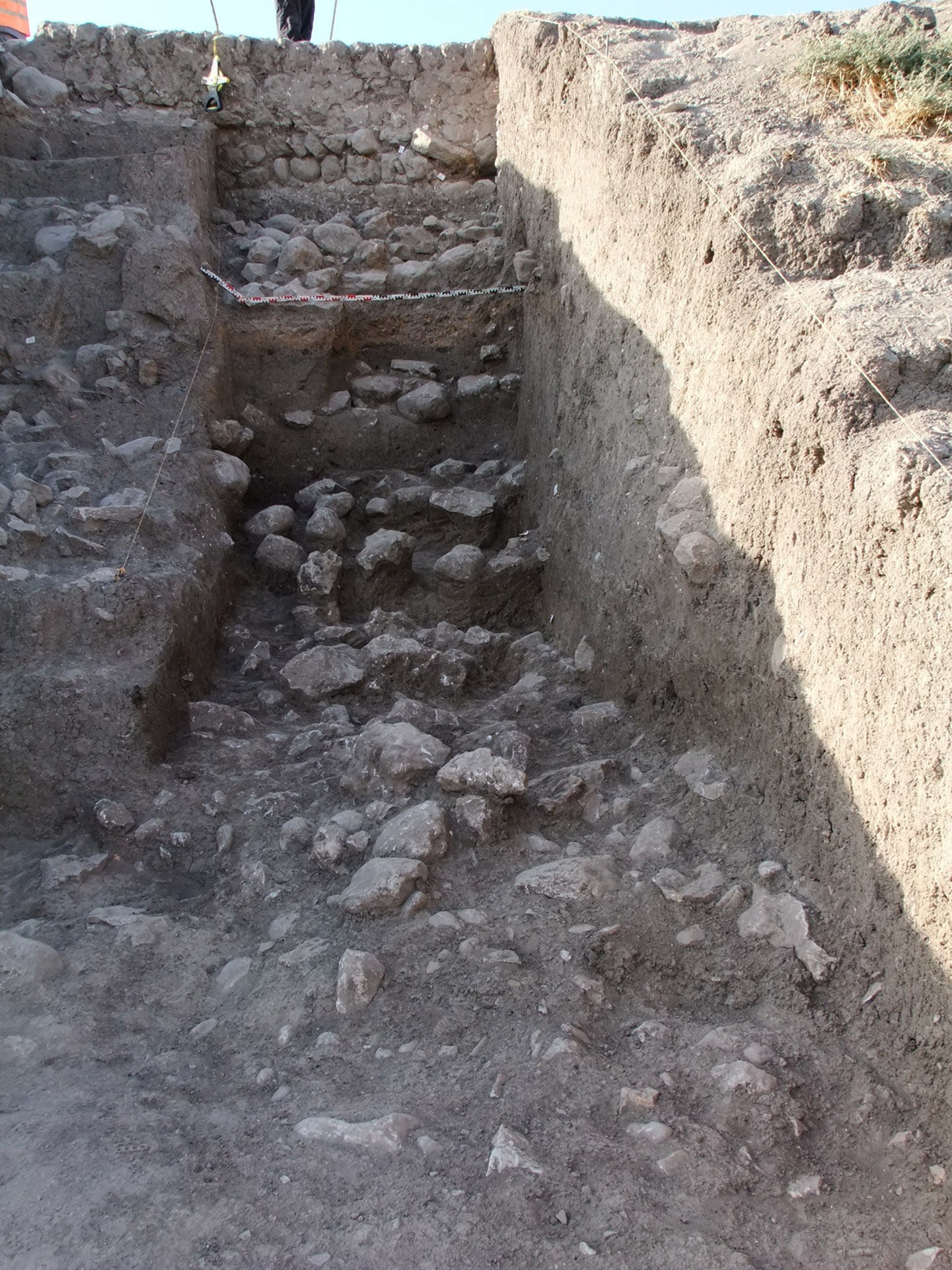
The first autopsy of the site made it clear that there is a stone wall running along the perimeter of the top of the tell just below the surface – sometimes the upper row of stones is stretching out from below. It was consequently also clear that the shape of the tell and the steep side (acclivity) of the tell is in a great part due to the wall(s) running around the (contemporary) edge(s) of the top of the tell.
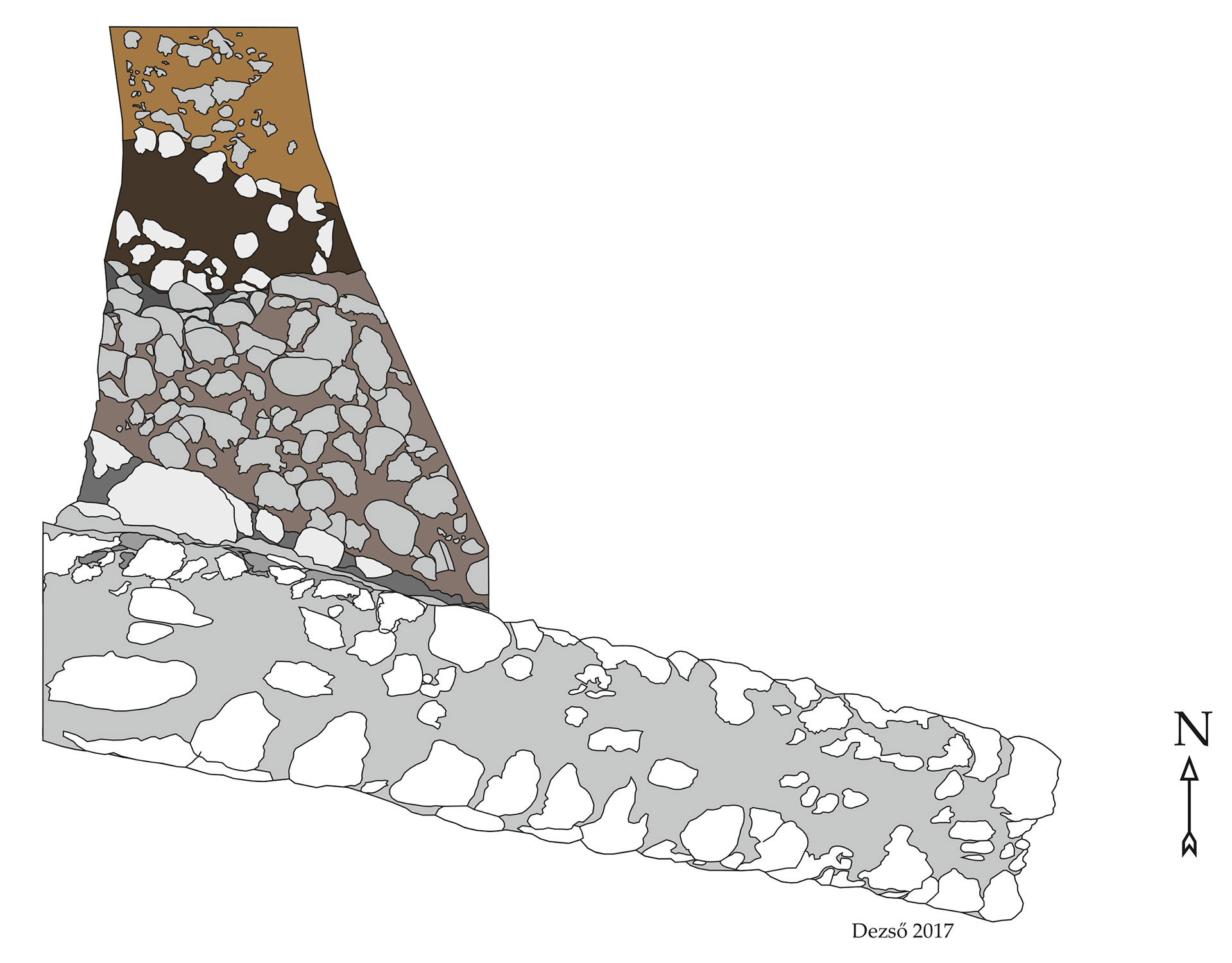
After four weeks of work in the NW trench at least eight phases of fortifications built on each other or behind each other including the remains of stone walls have been identified. The size of the 5 m wide trench eventually reached a 5 m depth and 9 m in length.


Prelminiary conclusions
Following this brief overview of the strata identfied during the first season of excavations some preliminary conclusions may be drawn.
The walls
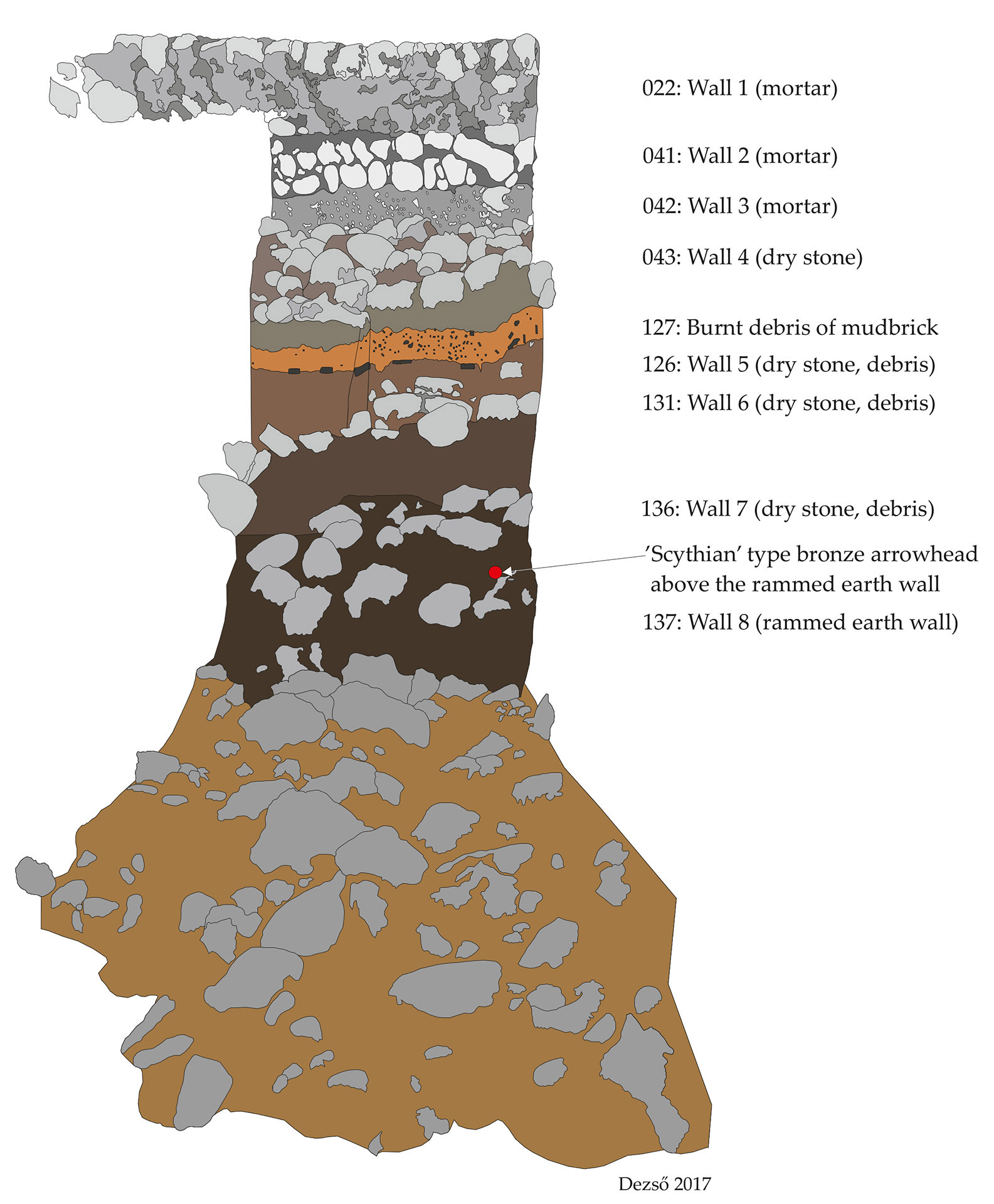
At least eight different phases of fortifications or their remains were identified in the NW Trench (790.540) of Field 01. The three latest phases (Walls 1–3) were built with the extensive use of mortar, the following four walls (Walls 4–7) were dry stone walls, but only the consecutive stone rubble debris layers of these destroyed walls were identified. The earliest identified phase (Wall 8) seems to be a rammed earth wall. At the present stage of research it is clear that the site was seriously fortified during several periods of its history until the Late Islamic period.
The chronology
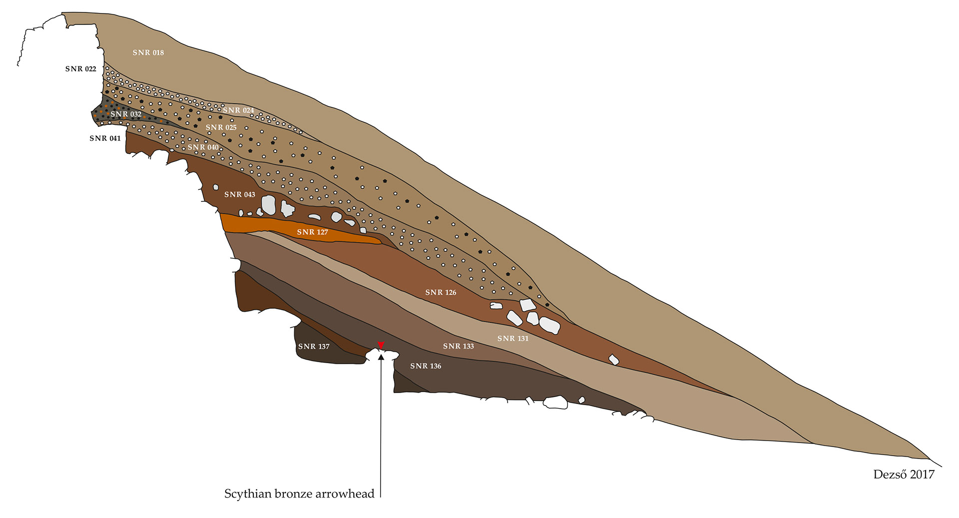
The main problem concerning the evaluation of the remains of the NW Trench is that this part of the site contains mainly or only debris layers accumulated outside the fortification walls, on the slope of the settlement. Consequently no homogeneous settlement layers were presented that would produce a coherent picture and clear pottery assemblages. The pottery of the NW Trench came from the refuse discarded outside the walls and consequently was very mixed. The excavations on the inner side of the ramparts have not produced yet a sufficient amount of ceramic finds to establish an acceptable chronology for the whole sequence of investgated strata. However, other finds (clay pipes, arrowheads, a fragment of a bronze bowl, and a Hellenistic Greek coin) enable us to lay the foundations of a rough prelimiary chronological framework for this part of the site.
It seems clear that the strata above the layers SNR 126 and 127 (SNR 018, 022, 024, 025, 028, 032, 124, 125) most probable belong to the Islamic Period of the site. The combined layers of SNR 126 and 127 (and the other layers beneath them) do not contain Islamic pottery or other remains dated to the Medieval or Early Modern Periods. There is, however, a question still to be answered concerning the chronology of theWalls 2–3 whether they belong to an earlier or to a later phase of the site.
The next chronological horizon is signalled by the Hellenistic Greek coin from the debris of SNR 126. Since another Hellenistic Greek coin (a silver drachm from the Lampsacos drachm mint) was found in Field 02, and a further surface find from the western slope of the tell: a large (rim and side) fragment of a Hellenistic vase (lutrophoros?) decorated with a black coating and wide splendid silver(!) bands are also indicative, it can be assumed that there was a Hellenistic settlement on and around the tell.
The earliest chronological horizon identified in NW Trench is dated to the 7th—6th centuries B.C. This horizon is represented by strata SNR 133 and 136 and below (SNR 137). Obviously not the architectural remains help us to date these levels. The small (metal) finds found in these levels (arrowheads, fragment of a bronze bowl) hint to the direction that in the NW Trench in a depth of 5 m we reached the 7th—6th centuries B.C. layers. The appearance of more than one arrowhead (4 pieces in a 2 m wide stretch) in the outside face of the wall (Wall 7) refers to an attack or a siege of the settlement somewhen in the 7th or 6th century B.C. (at the time of the fall of Assyria?). It is not sure yet if these layers represent the (Neo-)Assyrian Period or a Post-Assyrian (Neo-Babylonian?) culture, but it seems quite clear that in this depth (at around 25 m height in the tell), we reached the ancient Near Eastern strata. Hopefully, in the next season these questions will be answered and the chronological framework of the upper strata of the site will be clarified.
The Post-Medieval Settlement at Grd-i Tle (Field 1)
Field 1 situated on the edge of the upper plateau of the Grd-i Tle archaeological site had as a goal to create a stratigraphical sequence of the ceramic from the latest phases of the inhabitation. The first season of excavations at Field 1 at Grd-i Tle revealed an intensive post medieval settlement within the stone ramparts. Present paper gives a preliminary overview only of the research carried out on the settlement features within the ramparts discussed in a separate article. Works here were led by Maxim Mordovin and Zsófia Masek.
The intramural part of the settlement was excavated in two trenches: eastern and western, 4 m wide each. The reached depth significantly difiers due to more intensive stratigraphic situation in the western part. The deepest point reached in the western trench (from the present day level) is 1.2 m; in the eastern trench is 1.5 m. Since the connection of the particular features in the two parts of the excavated area was clearly observable, in the following their description will be given together.
The most important discovery at this location was the appearance of a mortar stone rampart wall, in average 0.8 m thick having at least three building phases. The dating of the construction of the wall cannot be yet clarified but according to the documented stratigraphy this wall strongly defined the latest building activity of the spot. However, it is undoubted that the excavated wall is part of a fortification. The military character of the structure is emphasised by a semi-circular tower excavated in the east-northern part of the trench.

Chronological Levels
Altogether three main settlement levels could have been separated, each of them consisted of several stratigraphic units. The character of all these levels is very similar, which fact refers to their chronological closeness.
The uppermost level (Level 1) is the most damaged one. It is compounded of two layers, including the upper one (SNR-001; SNR-003–004) and some hardly identifiable walls (SNR-044). In some cases traces of hearths and possible ovens were observed. The layers were composed of greyish brown earth with mortar debris and burnt daub fragments. The relatively high amount of stones most probably should be interpreted as foundations of walls destroyed by the recent anthropogenic activities at the site. There is no possibility to reconstruct in details the former layout for this level but at least two things can be stated. The first is, that the walls were most probably built of daub or mud bricks on stone foundations with no mortar. The last can be confirmed by the fact that no layer of stone and mortar debris has been identified in this area. And the second is that the walls were built arranging to the fortification line (SNR-002 and SNR-022) undoubtedly being later than that.
The second level (Level 2) survived much better than the upper one being only covered and not disturbed by the most recent features. It consisted altogether of three or sometimes four layers, the upper part of which was the filling or levelling layer above the lower former surface (SNR-027; SNR-134). Four stone foundations can be connected to this strata. All of them are very similar to those from the latest phases. The foundations usually were built of two or three, but no more than four rows of stones without mortar, and in average were 50–60 cm wide. All excavated foundations were strictly aligned to the outer fortification line being parallel or perpendicular to it. One of the walls at this level coated the main fortification from the inner side. Very close to the eastern edge of the western trench, an approximately 80 cm hiatus was observed in the coating wall, and at the same place the curtain wall of the site was broken through. The hiatus and the breach in the outer wall were connected and seemingly created a narrow doorway to the tower excavated in the north-eastern part of the Field 1. Since the presumed entrance remained unexcavated under the balk, the situation cannot be clarified yet. However, the fact that both the tower and the curtain wall were built using mortar, while the coating wall was not, the documented entrance cannot be the original way to the tower.

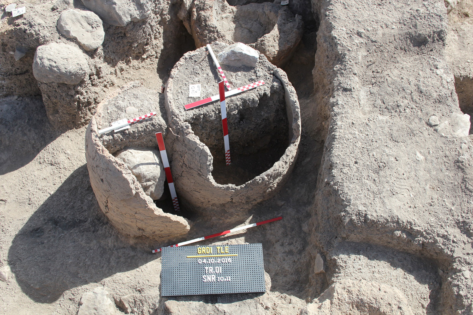
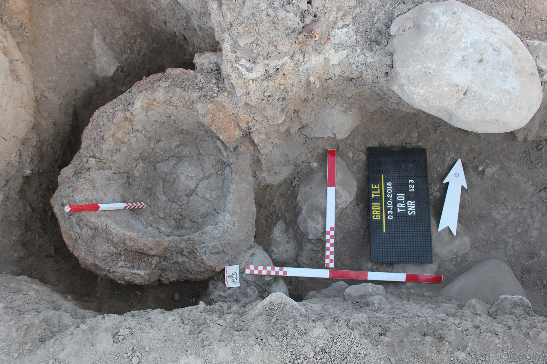


Several ovens and hearths associated with this level were found. Some of the ovens – locally called tannurs – survived relatively well (SNR-010-14; SNR-030; SNR-031; SNR-041 etc.). In at least two cases clear superpositions were observed showing renewal of the ovens. In the south-eastern corner of the eastern trench a pile of ceramic fragments from two or three vessels were documented lying on the contemporary surface of the Level 2. In the south-western corner of the same trench, and beside the eastern section of the western trench the original surface was paved with larger stone slabs (SNR-034; SNR-050 and probably SNR-115: Fig. 9). Presumably these two parts are connected under the unexcavated balk. Since the stone “floor” is not surrounded by any traceable walls, what is more, several foundations were laid on it, its function is hard to interpret yet.
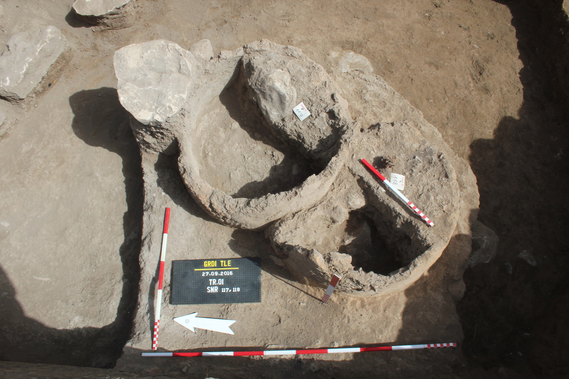
The third level (Level 3) was investigated only in the eastern trench. Its character is almost identical with that of the Level 2. Three main components can be mentioned: stone foundations of walls (SNR-121), ovens and smaller hearths (SNR-117-119), and relatively thick filling layer (SNR-116).
Only fragmentary architectural features can be assigned to Level 3 (SNR-121). The few dry stone wall foundations were arranged according to the outer fortification line. All of them were only 2–4 stone rows (30–40 cm) thick and 60–80 cm wide. It seems that they were placed directly on the surface with no foundation trenches.
The surface of the Level 3 was traced in 1.6 m depth from the present day level. It was harder than the filling layer above, in some places it was slightly burnt by occasional fires (hearths) and large tannurs were built upon it. Altogether three ovens have been excavated (SNR-117-119, Fig. 8), two of them in superposition. The filling layers of this level were similar to those in strata above. They consisted of greyish brown earth with charcoal debris and burnt daub fragments with relatively high quantity of pottery sherds and archaeozoological material. The filling most probably originated from the wattle-and-daub or simply daub walls used to stand on the excavated stone foundations. During their destruction and levelling some stones were scattered in the filling. Noteworthy that the walls of the tannurs survived in remarkably good condition implying to a relatively fast process of filling up. At the same time several traces of thin hearths with ashes and charcoal refer to that it was not done at once but gradually, presumably in some weeks or months.
The surface of this level at the largest part of the excavated territory was simple rammed, hard earth difiering from the neighbouring layers in larger amount of scattered pottery sherds, archaeozoological remains, irregularly lying stones. Many hardly observable occasional sites of fire (shallow hearths) were seen on this surface.
Pottery
The most important and yet the only dating group of finds from this part of excavation is pottery. The preliminary evaluation of the ceramic finds has not been finished on the spot due to the unexpected complexity of the stratigraphic situation. The uppermost layers proved to be very mixed including fragments originated from several much earlier levels. These fragments represent a broader spectre of ceramics starting from Neolithic painted ware, throughout Hellenistic-Parthian wheel-turned pottery up to the Late Islamic production. This character of the layers undoubtedly implies to a larger extent of damage of the earlier strata. The evaluation of the ceramic material of the site is based on the distinction both of the material-technological groups (e.g. tempering, technology, firing, surface treatment) and their physical characteristics.
The overall analyses of the ceramic assemblage of the site have to be prepared only in an inclusive way that is the whole chronological spectre of the pottery should be evaluated simultaneously, while the establishing and closer defining of chronological groups within the diagnostic material will be outlined and refined gradually getting lower and acquiring additional information from well stratified closed assemblages.
According to the present stage of the evaluation relatively small amount of the ceramic material can be associated with the latest phases of the site. Fragments of heavily tempered, hand-formed, oxidation-fired jugs, occasionally with incised decoration were scattered throughout the upper layers. Beside the foundation of the tower, in the layer SNR-045 larger parts of a hand-formed pot with a handle were found. A heavily-tempered, crude, hand-formed storage jar was documented lying on the surface (SNR-027) of the latest phase. Fragments of several wheel-turned, turquoise-glazed jugs were collected from the Late Islamic features, including the filling of an oven (SNR-030).
A special group of ceramic finds of the site is represented by terracotta tobacco pipes. Altogether several dozens of such pipes have been collected so far, showing several types.
Conclusion
The observations confirms existence of at least three main habitation strata all datable to the so-called “Late Islamic” period. The finds of lead bullets and – most of all – particular types of pipes enable to define this period to the 18th and early 19th century. The excavated location in the Field 1 seems to have been a domestic part of the latest fortification complex. This is confirmed by the large number of bread-baking ovens observed on every settlement strata. The presence of the bullets at the same time unambiguously refers to somewhat confiict in that time explainable later in context of local history.
Evaluating the latest phases of the settlement, more exactly the reusing of the earlier fortifications during the 18th-19th centuries it can be clearly stated that the inhabitants can be identified with the local Kurdish population. Even the possibility of the Kurdish origin of the mortar walls cannot be excluded but this can be clarified via further excavations.
Munkatársak 2016
Dr. Dezső Tamás
ásatásvezető
Dr. Kalla Gábor
ásatásvezető
Barzan Baiz Ismail
régész felügyelő
Kamal Rasheed
régész felügyelő
Dr. Mordovin Maxim
régész
Masek Zsófia
régész
szabó Nóra
régészhallgató
Ardalan Khwsnaw
régészhallgató
Aram Ali Hama Amin
régészhallgató
Weisz Attila
geodézia
sándor Lajos
fémdetektor